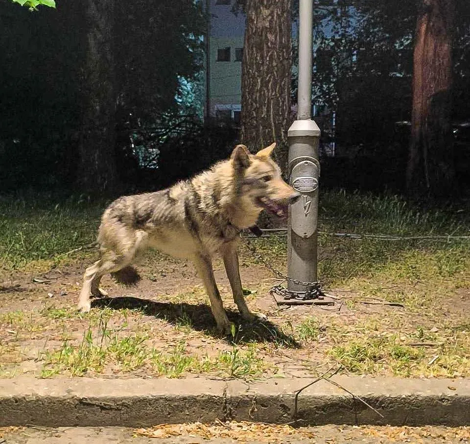
A Wolf on a Chain in Kozle: Fines Up to 20,000 Euros, But No Rescue Centre - The System Only Wakes Up When It Spills Onto the Street
15.05.2026
15.05.2026

15.05.2026
15.05.2026

15.05.2026

15.05.2026

15.05.2026
15.05.2026

14.05.2026

14.05.2026

15.05.2026

15.05.2026

14.05.2026

15.05.2026

15.05.2026

15.05.2026
15.05.2026

14.05.2026

13.05.2026

15.05.2026

15.05.2026

15.05.2026

15.05.2026
14.05.2026

14.05.2026

09.03.2026

27.02.2026

19.02.2026

14.04.2026

07.11.2025
07.11.2025
23.04.2026
23.04.2026

12.04.2026

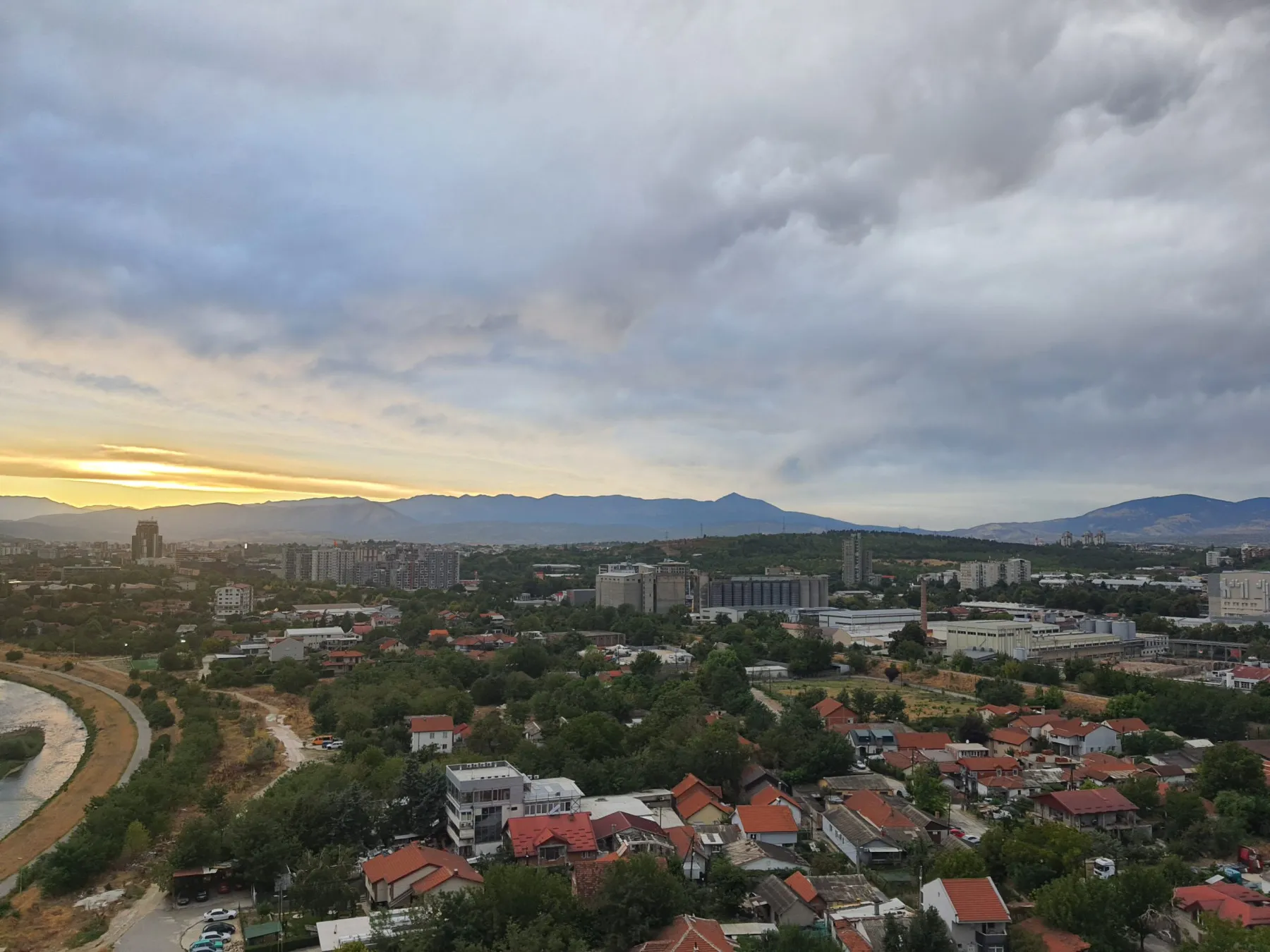
Today - sun and unstable cloudiness, temperatures up to 26 degrees. Tomorrow, Saturday, 16 May - a radical change. Cyclonic activity in the Italian region (the Genoa cyclone) will reach Macedonia and bring rain, thunder, strong wind from the south and south-west, and locally heavy downpour conditions. The Meteo Alarm forecast is that in some spots, more than 30 litres per square metre could fall, accompanied by winds over 70 kilometres per hour and possible hail.
The morning will be cool - 7 to 14 degrees. Daytime - 17 to 23. In Skopje: 11 degrees in the morning, up to 22 in the afternoon. But unlike the standard afternoon summer instability, this is part of a bigger cyclonic structure - which means the conditions are not limited to a single basin-mountain area, but cover a larger share of the country's territory.
May and June in Macedonia traditionally bring the largest material damage from storms - hail in agricultural areas, flash floods in urban neighbourhoods that were never designed for underground drainage, and overflowing of smaller rivers. The Skopje sewage and drainage network has, for years, been unable to handle the intensity of "short but heavy" rainfall. When 30 litres per square metre fall in one to two hours, much of the city's underpasses and underground car parks fill with water.
The recommendation is standard and predictable: avoid open spaces and isolated trees during thunderstorms, protect vehicles from strong winds. The less standard recommendation: check how the streets around your home drain and how the underpass you drive through behaves. Cyclones come and go in a few hours. The damage they leave behind sticks around longer.
The latest 10 news from this category
The law exists. The fines exist. What does not exist: a rescue facility, a rehabilitation programme, and enough oversight to...
4 million in the budget, 70 families so far. This is the policy of "let\'s salute the parents," not "let\'s...
"Planned technical interventions." Citizens: stock up on reserves and wait. The city\'s infrastructure runs on a linear model - no...

New GUP, ring roads, tourism, education - all in one press release, nothing concrete. The diplomatic-visit genre, with no follow-through.
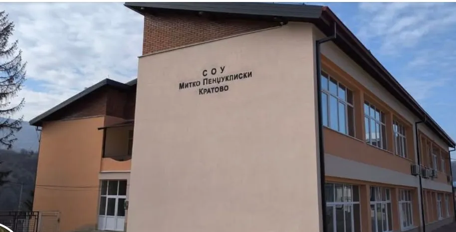
Small municipalities have been losing young people for decades. Kratovo is the first to try something concrete: money for those...
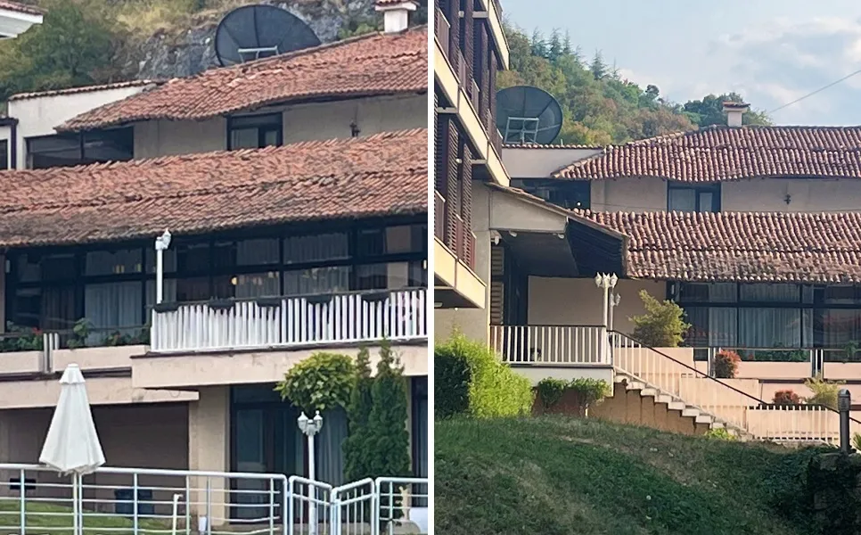
Repair order with a deadline of 30 April. 1 May - full capacity. Today - same roof, same guests, same...
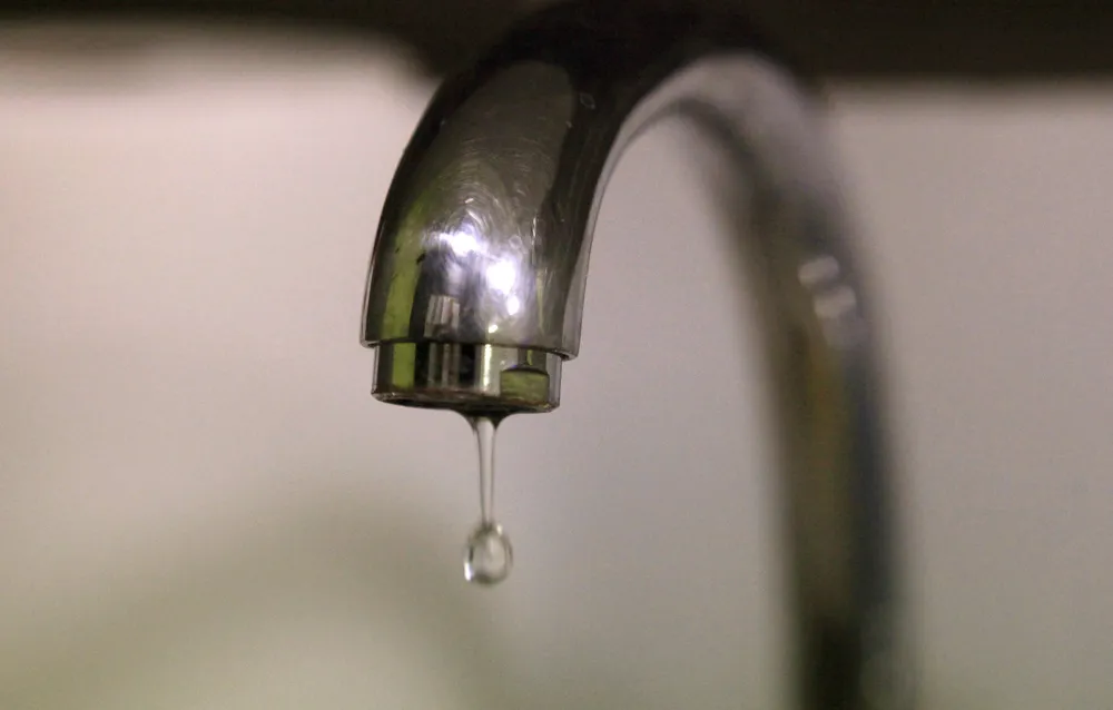
Tens of thousands of residents without water for a working day. The pipes date back to the 70s. „Repairs underway."...
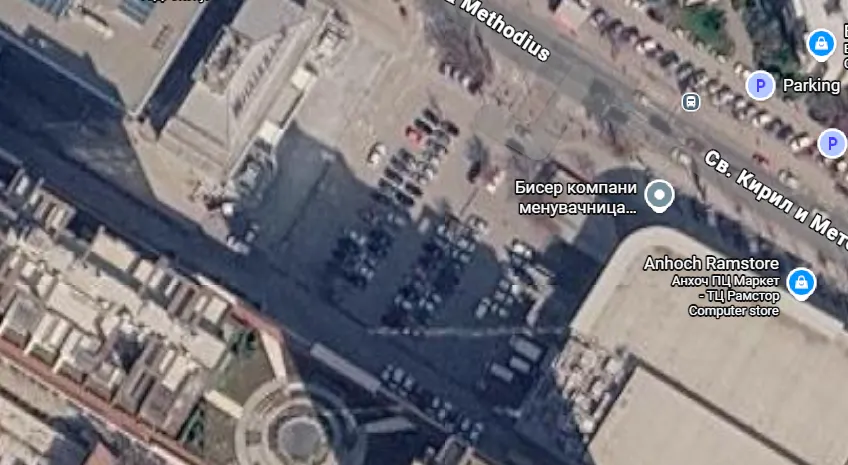
Free parking is becoming an underground paid one. That's not a „swap" - that's privatising a public utility with a...

From May 18 to mid-July, with dedicated containers across the neighbourhoods. A solution for spring. Nothing at all for the...

Funk Shui and Dejan Deks in front of the Officers' Hall. „Our Europe. Stronger together." A slogan that, translated, means...